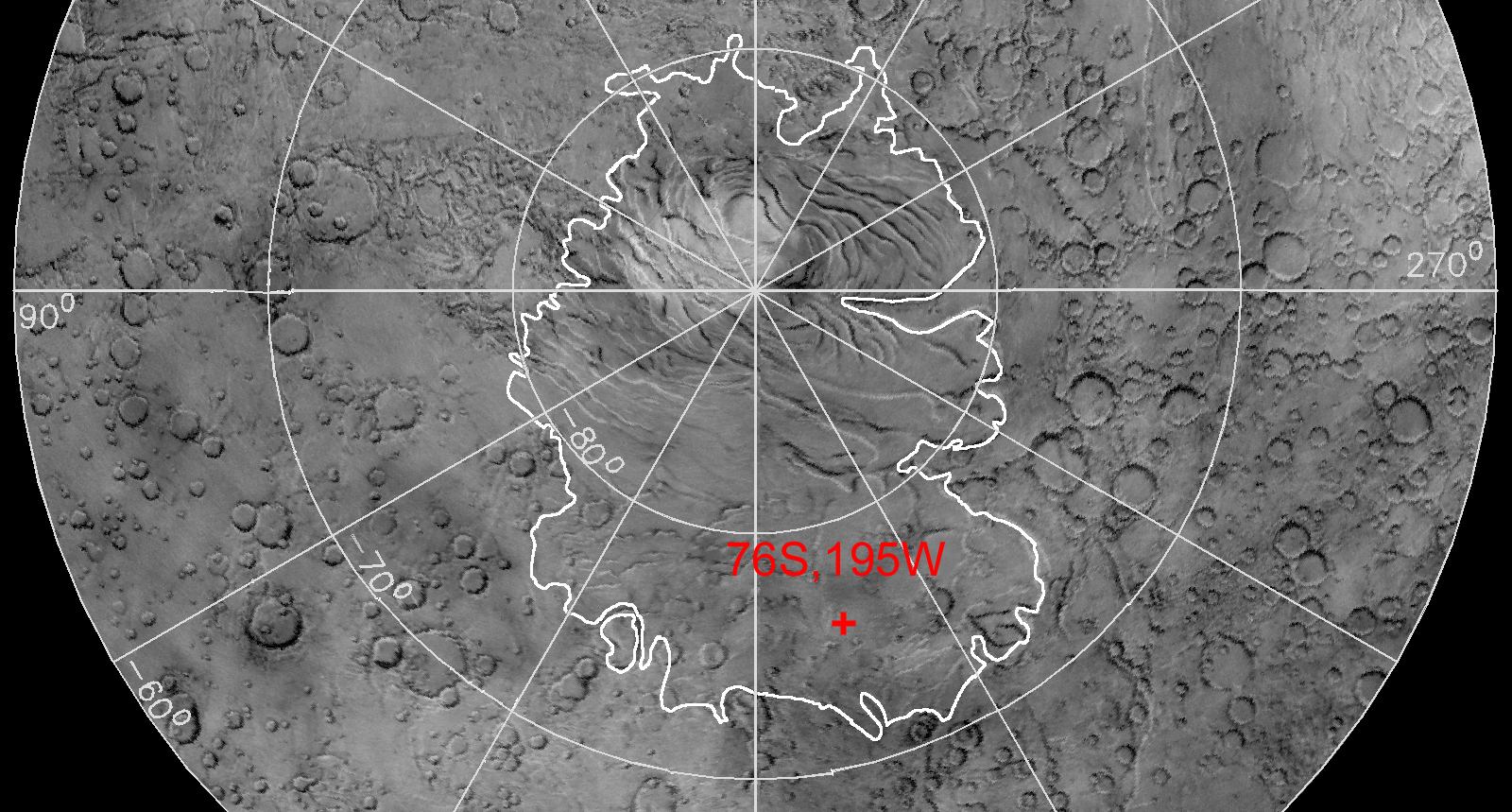
Mars Polar Lander Mars Polar Lander Mars Volatiles and Climate Surveyor (MVACS) Lidar and Mars Microphone Mars Descent Imager (MARDI) Deep Space 2 Microprobes Deep Space 2 Microprobes Deep Space 2 Microprobes Jet Propulsion Laboratory NASA UCLA Images, Images, Images Current Mission Status & News What We Hope To Learn Our Mission Mars Exploration Comments Or Questions? To Find Your Way Around Mars Polar Lander Homepage Mars Volatiles and Climate Surveyor (MVACS)
MVACS Overview
Instruments
Latest Results
LIVE! Downlink
Mission Highlights
Status & Timeline
Media Tools
Partner Websites
MVACS Homepage
To Find Your Way AroundWho Made This Site?Cool Links! Meet the Team! Comments or Questions?
Click to Enlarge -- Caption

The Polar Landing Site of the Mars Polar Lander

NASA and the Mars Polar Lander Team selected a target landing site of 76 degrees south latitude and 195 degrees west longitude. The landing site is on the enigmatic "polar layered deposits" (outlined in white above), which may have been created by Mars' changing climate.

Images from the Mars Orbiter Camera (MOC) and topographic data from the Mars Orbiter Laser Altimeter (MOLA), both aboard the Mars Global Surveyor spacecraft currently at Mars, helped the team identify areas that were both safe and scientifically interesting. The links below introduce the landing site and review the site selection process.

Click to Enlarge -- Caption

Read more about it...

  • Landing Site Fact Sheet
  • MOC Landing Site Images - within Malin Space Science Systems' site
  • MOLA Landing Site Observations - within the MOLA Team site
  • Current Temperatures - within the Thermal Emission Spectrometer (TES) site at the USGS
  • Science and Engineering Guidelines - Where the spacecraft is capable of going, and what we looked for in a landing site
  • Timeline - Important landing site events