(Earth ellipse artwork prepared by Robin Vaughan)


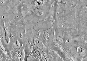
The Pathfinder landing site passed a series of rigorous engineering constraints related to landing safely: sufficient sunlight, acceptable slopes, surface roughness, dust low elevation for sufficient atmospheric density, low dust storm potential, etc. This site also provides the opportunity for rich science data return. It is located near the mouth of a catastrophic flood channel debouching into Chryse Planitia, and is called a "grab bag" site for its potential for sampling a wide variety of different martian crustal materials, such as Noachian plateau material (a.k.a., ancient crust) as well as Hesperian Ridged Plains and a variety of reworked channel materials. Even though the exact provenance of the samples would not be known, data from subsequent orbital remote sensing missions could then be used to infer the provenance for the "ground truth" samples studied by Pathfinder. Available data suggest the site is about as rocky as the Viking sites, but perhaps a bit less dusty. This site has streamlined islands nearby and a very smooth depositional surface at Viking resolution (on the order of 40 m/pixel), except for large (hundreds of meters) blocks or hills and small secondary craters.
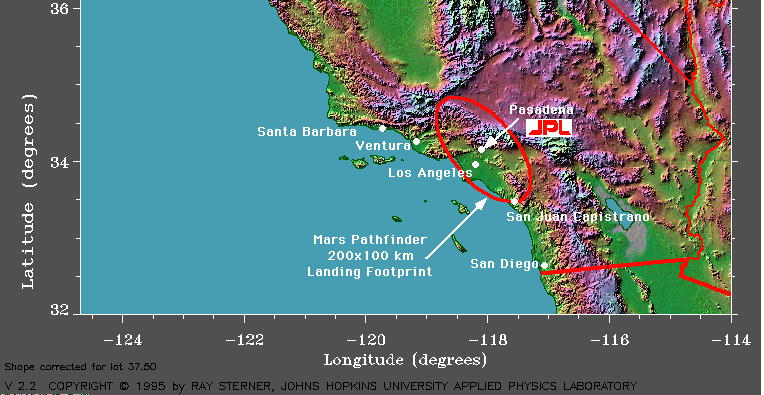
The landing site on Mars is 200 km at its widest point by 70 km at its longest point. As you can see in the image on the right, we have superimposed a landing ellipse on a map of California with JPL and Pasadena at its center. In the north it stretches up to the Tehachapi Mountains and, in the south to the mission at San Juan Capistrano (where the famous swallows return each Spring). To the west it touches Pacific Palisades, right on the Pacific Ocean, and eastward is well into the Inland Empire.
For a more detailed explanation of the landing ellipse and how it is generated, please go to the Mars Pathfinder Trajectory Data page.
 |
 |
Back to the Mars Pathfinder Home Page