
14-APR-98 1:45 PM PDT
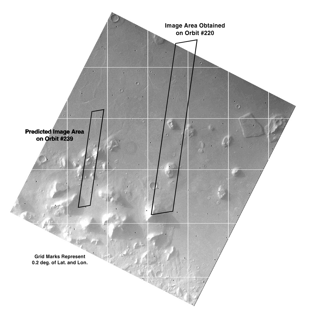
In the second Cydonia observation from Orbit #239, the slant range to the target site is 196 miles (317 km), as compared to 275 miles (444 km) in the first observation on Orbit #220. The slant range is not a parameter controlled by the flight team. Instead, it depends on the location of the orbit relative to the location of the target, and will vary from orbit to orbit. Similar to cameras on Earth with a fixed lens size, decreasing the range to the target will yield a narrower field of view.
For example, both the first and second images of the Cydonia region have a pixel width of 1024. Since the slant range is smaller in the second image, the resolution is 8.13 feet (2.48 meters) per pixel as compared to 14.1 feet (4.3 meters) per pixel in the first image. In other words, the swath size encompassing the region observed from Orbit #239 is smaller. However, the resolution is higher than for the swath obtained from Orbit #220. The second Cydonia image covers an area 1.6 miles (2.54 km) across by 14.7 miles (23.81 km) long with a resulting resolution 20 times higher than the best previous image taken by the Viking Mission in the mid-1970's. The first Cydonia image covers an area 2.7 miles (4.4 km) wide and 25.7 miles (41.5 km) long, yielding a resolution 10 times higher than from Viking.
The raw image of the Cydonia region from Orbit #239 is schedule for release
late this afternoon.
The enhanced version should be available in the early evening Pacific Time.