NATIONAL AERONAUTICS AND SPACE ADMINISTRATION
CALIFORNIA INSTITUTE OF TECHNOLOGY
JET PROPULSION LABORATORY
PASADENA, CALIFORNIA 91109
MEDIA RELATIONS OFFICE
TELEPHONE (818) 354-5011
http://www.jpl.nasa.gov
RAW IMAGE POSTED - April 14, 1998 6:30 PM Pacific Daylight Savings Time
CONTRAST ENHANCED IMAGES POSTED - April 14, 1998 8:30 PM Pacific Daylight Savings Time
Map Showing Location of MGS Data to Viking Frame 035A72 ( 0.5 MB )
Complete Record of Targeted Observations
MGS Home Page
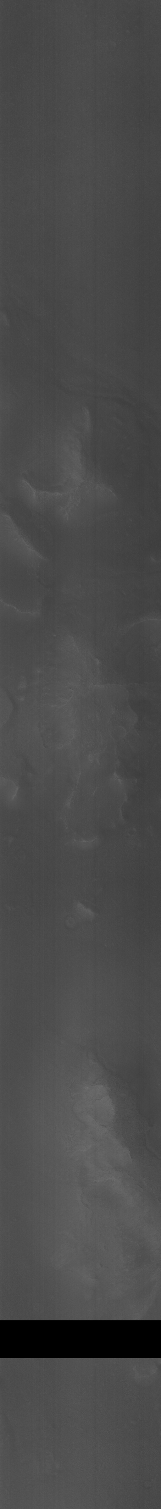
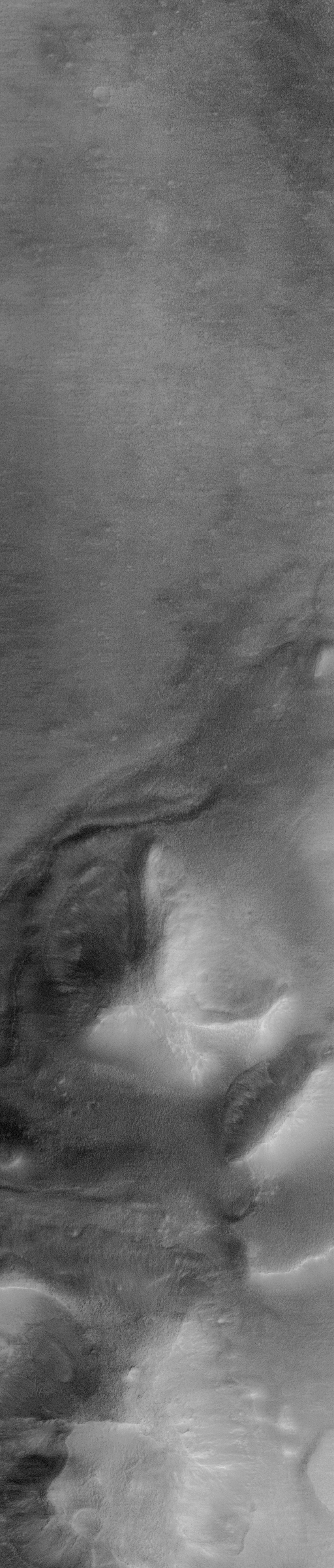
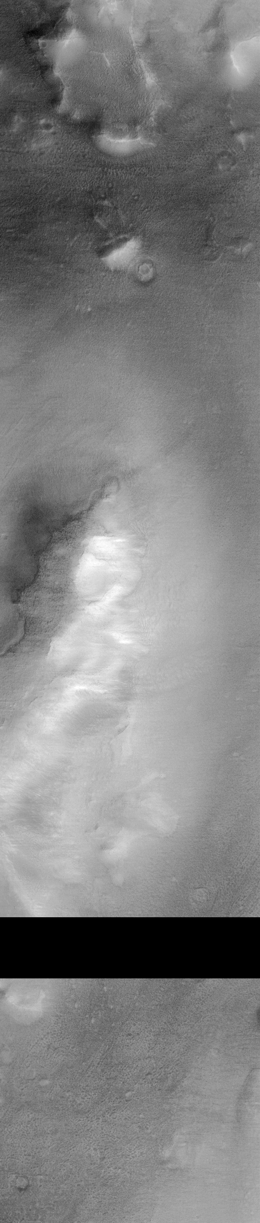
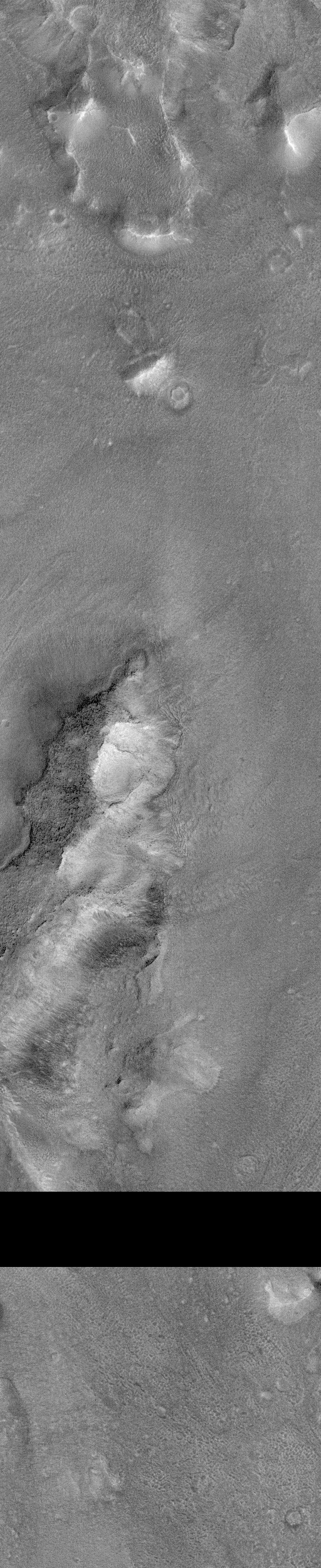
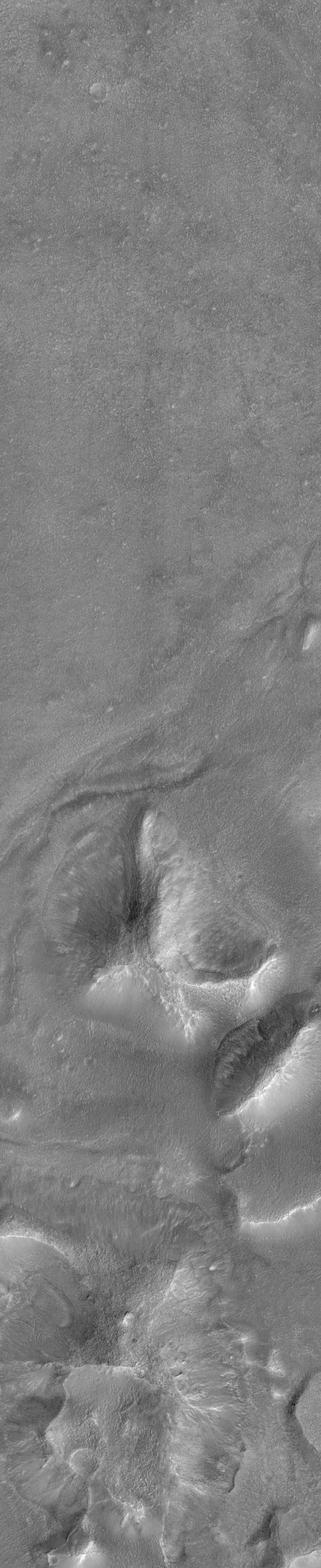
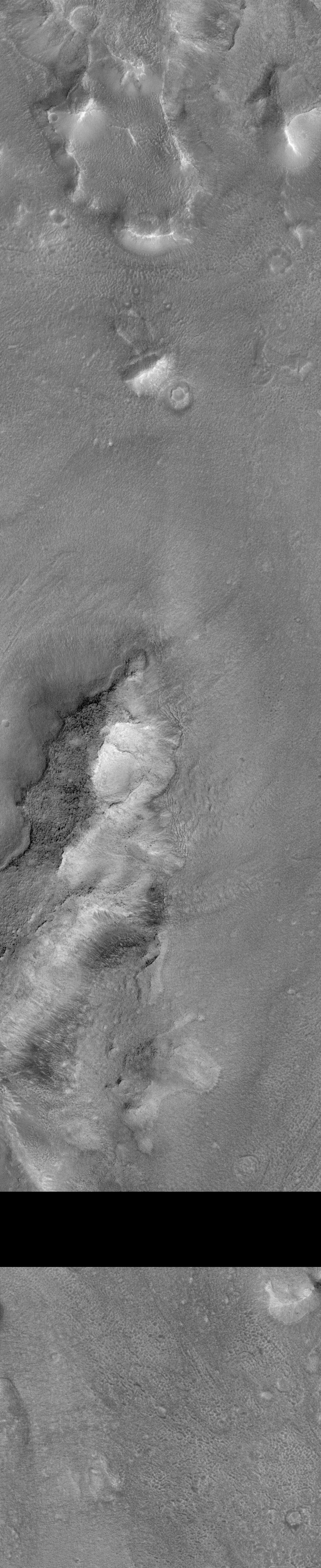
CYDONIA REGION - OBSERVATION #2
CYDONIA OBSERVATION #2 PHOTO CAPTION
Orbit: 239
Range: 331.07 km
Resolution: 2.5 m/pixel
Image dimensions: 1024 X 9600 pixels, 2.5 km x 24 km
Line time: 0.35 msec
Emission angle: 2.35 degrees
Incidence angle: 66.77 degrees
Phase angle: 68.81 degrees
Scan rate: ~0.15 degree/sec
Start time: periapsis + 375 sec
Sequence submitted to JPL: Mon 04/13/98 16:40 PDT
Image acquired by MOC: Tue 04/14/98 07:02:17 PDT
Data retrieved from JPL: Tue 04/14/98 17:30 PDT
JPL Clarification: Tue 04/14/98 8:30 PM PDT
Image is approximately 1.5 kilometers to the left of the targeted region.
Please note that the original RAW IMAGE file is in the orientation
as it was received from the spacecraft. All enhanced versions are
flipped from left to right to yield the correct orientation. This was
done so that the images are in the same orientation as the Viking data.
Please also note that we are still querying the Deep Space Network Stations
for data. If all data can be recovered the black band in lower portion
of the image should be corrected.
Processing Performed by Tim J. Parker, Geologist
Mars Pathfinder Science Support, JPL.
Image Processing Steps:
(1) Vertical banding in raw image removed using Vicar software with long,
narrow, highpass box filter, oriented parallel to banding in image.
(2) Performed moderate histogram stretch in Adobe Photoshop on
Macintosh desktop computer.
(3) "Flattened" broad shading variations in scene by
copying image and creating a "mask" in Photoshop with
the shading inverted with respect to the original image. This mask
was then merged with original scene and a second histogram stretch performed.
Processing Performed by MIPL, JPL
Image Processing Steps:
(1) The image is sized down by interpolation by a factor of two to
reduce some of the noise.
(2) A long, narrow high-pass filter is applied in a vertical orientation
to help reduce some of the instrument signature. This signature is seen
as the streaking that is noticeable in the original data.
(3) A long, narrow low-pass filter is applied in a horizontal orientation
to create an intensity average for the image.
(4) The results of these filtering operations are the stretched to
approximate a Gaussian distribution.
(5) The results of the high-pass and low-pass processing steps are
averaged together to form the final product.
(6) The image is flipped about the vertical axis to correct for the
camera orientation.
MEDIUM RESOLUTION IMAGE ( cydonia2m.gif 1.2 MB ) FULL RESOLUTION TIFF IMAGE ( cydonia2.tif 9.6 MB )
MEDIUM RESOLUTION IMAGE ( cydonia2m_mipl_top.gif 1.1 MB ) FULL RESOLUTION GIF IMAGE ( cydonia2_mipl_top.gif 4.3 MB ) BOTTOM PORTION
MEDIUM RESOLUTION IMAGE ( cydonia2m_mipl_bot.gif 1.0 MB ) FULL RESOLUTION GIF IMAGE ( cydonia2_mipl_bot.gif 4.0 MB ) FULL RESOLUTION TIFF IMAGE ( cydonia2_mipl.tif 9.6 MB )
MEDIUM RESOLUTION IMAGE ( cydonia2m_tjp_top.gif 0.9 MB ) FULL RESOLUTION GIF IMAGE ( cydonia2_tjp_top.gif 3.5 MB ) BOTTOM PORTION
MEDIUM RESOLUTION IMAGE ( cydonia2m_tjp_bot.gif 0.9 MB ) FULL RESOLUTION GIF IMAGE ( cydonia2_tjp_bot.gif 3.4 MB ) FULL RESOLUTION TIFF IMAGE ( cydonia2_tjp.tif 9.6 MB )
