 |
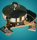
This altitude determination process works by measuring the time that a pulse of light takes to leave the spacecraft, reflect off of the ground, and return to MOLA's collecting mirror. By multiplying the reflection time by the speed of light, scientists will be able to calculate Surveyor's altitude above the local terrain to within 30 meters (98 feet) or better.
As the spacecraft flies above hills, valleys, craters, and other surface features, its altitude above the ground will constantly change. A combination of MOLA data with images from the camera will allow scientists to construct a detailed topographical atlas of the planet. Such maps will help in the understanding of the geological forces that shaped Mars.