 |
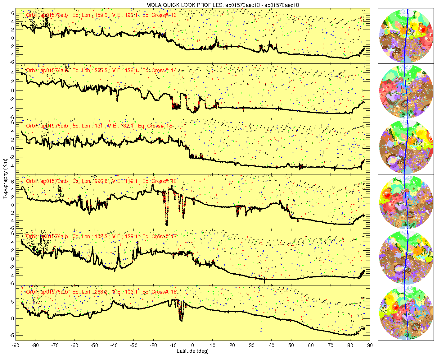
The MOLA instrument initiated near-continuous global profiling of Mars on March 1, 1999 and is providing the first high precision measurements of topography in Mars' southern hemisphere. The initial data were presented at the Lunar and Planetary Science Conference in Houston, TX on Tuesday, March 16, 1999. Below are some examples of early profiles collected during the MOC calibration period. These data have preliminary orbits removed but are otherwise uncorrected and are meant to provide a quick look at the kinds of data that are being obtained by MOLA.
|
In these profiles the south pole is at the left of the diagram and the north pole is at the right. Profile locations are shown by the blue lines superimposed on the Mars geological maps at the far right. Note the difference between the rough, heavily cratered southern highlands and the smooth northern lowlands, the latter of which have already been profiled by MOLA during MGS aerobraking hiatus and science phasing orbits. The second profile from the top shows detached plateaus at the transition between the southern highlands and northern lowlands. The fourth profile crosses the Valles Marineris canyon system, and the fifth crosses the easternmost part of the Hellas basin. The bottom profile crosses the Labyrinthus Noctis chasms that mark the center of the Tharsis rise. In these profiles the along-track laser shot spacing is ~300 m and the maximum vertical resolution is 37 cm. The widely scattered reflections above the ground are due to background noise at the laser wavelength and optical test source pulses that make up about 0.1% of the outgoing pulses. Clusters of reflections above the ground in the south polar region correspond to clouds. (Credit: MOLA Science Team)
See: Mars Orbiter Laser Altimeter (MOLA) at GSFC for more information.