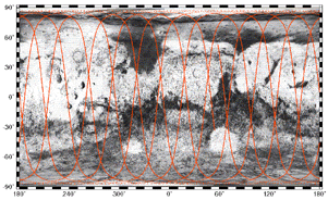
In the ground track below, the position of the spacecraft is represented
by the point at which the red ground track line intersects the green leader.
The green leader represents the region that MGS will fly over in the next
10 minutes. The red line shows the ground track over the surface of Mars
for the past 3 hours. This image updates once every 2 minutes; hit reload
on your browser for the latest image. ( See Map Below
for Surface Features )
 Click Here for Page with Automatic
Image Refresh
 Sample Track for 27-JAN-2000 - Click
on Image for Larger View
 |