
Mars Global Surveyor Mars Orbiter Camera Release:          MOC2-77
Mars Global Surveyor Mars Orbiter Camera Image ID:         589266586.53104
                                                           P531-04
CAPTION
The Mars Global Surveyor (MGS) Mars Orbiter Camera (MOC) was designed specifically to provide images of Mars that have a resolution comparable to the aerial photographs commonly used by earth scientists to study geological processes and map landforms on our home planet. When MGS reaches its Mapping Orbit in March 1999, MOC will be able to obtain pictures with spatial resolutions of 1.5 meters (5 feet) per pixel--this is good enough to easily see objects the size of an automobile.Boulders are one of the keys to determining which processes have eroded, transported, and deposited material on Mars (e.g., landslides, mudflows, flood debris). During the first year in orbit, MGS MOC obtained pictures with resolutions between 2 and 30 meters (7 to 98 feet) per pixel. It was found that boulders are difficult to identify on Mars in images with resolutions worse than about 2-3 meters per pixel. Although not known when the MOC was designed, "thresholds" like this are found on Earth, too. The MOC's 1.5 m/pixel resolution was a compromise between (1) the anticipation of such resolution-dependent sensitivity based on our exerience with Earth and (2) the cost in terms of mass if we had built a larger telescope to get a higher resolution.
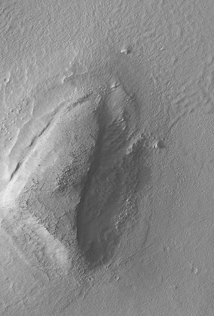
Some rather larger boulders (i.e., larger than about 10 meters--or yards--in size) have already been seen on Mars by the orbiting camera. This is a feat similar to that which can be obtained by "spy" satellites on Earth. The MOC image 53104 subframe shown above features a low, rounded hill in southeastern Utopia Planitia. Each of the small, lumpy features on the top of this hill is a boulder. In this picture, boulders are not seen on the surrounding plain. These boulders are interpreted to be the remants of a layer of harder rock that once covered the top of the hill, but was subsequently eroded and broken up by weathering and wind processes.
MOC image 53104 was taken on September 2, 1998. The subframe shows an area 2.2 km by 3.3 km (1.4 miles by 2.7 miles). The image has a resolution of about 3.25 meters (10.7 feet) per pixel. The subframe is centered at 41.0°N latitude and 207.3°W longitude. (CLICK HERE for a context image). North is approximately up, illumination is from the left.
|
Click Here for more information on MGS data release and archiving plans. |
Malin Space Science Systems and the California Institute of Technology built the MOC using spare hardware from the Mars Observer mission. MSSS operates the camera from its facilities in San Diego, CA. The Jet Propulsion Laboratory's Mars Surveyor Operations Project operates the Mars Global Surveyor spacecraft with its industrial partner, Lockheed Martin Astronautics, from facilities in Pasadena, CA and Denver, CO.
Contact: info@msss.com
 To MSSS
Home Page
To MSSS
Home Page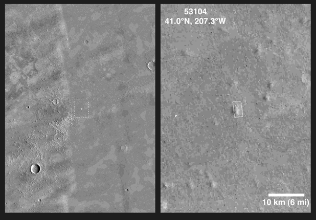