
Mars Global Surveyor Mars Orbiter Camera Release:          MOC2-35A, -35B, -35C
Mars Global Surveyor Mars Orbiter Camera Image ID:         568083867.7908
                                                           P079-08
|
Click Here for more information on MGS data release and archiving plans. |
CAPTION
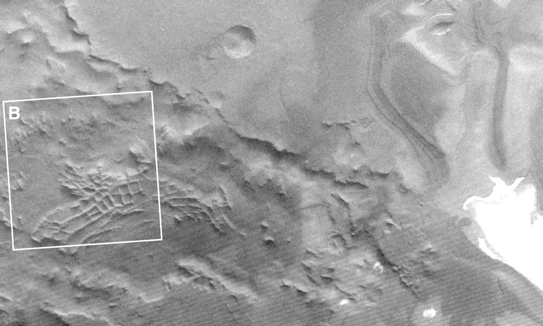
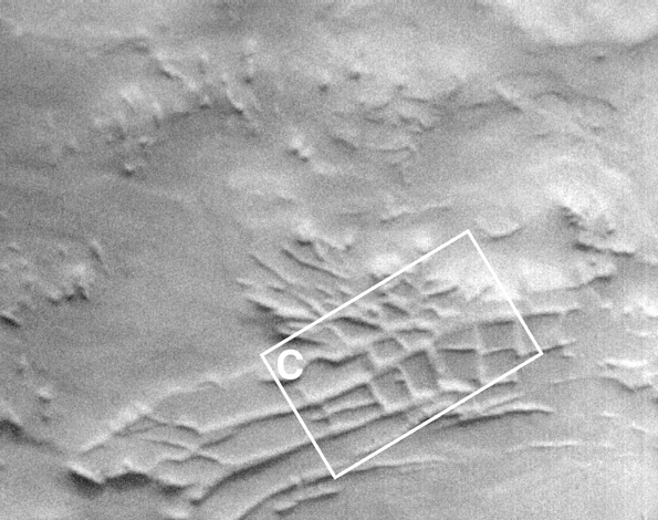
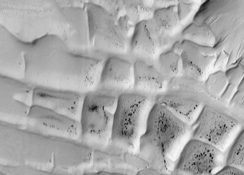
This set of rectilinear, intersecting ridges was first seen in images taken by Mariner 9 in 1972 (see context frame B). The superficial resemblance to ancient ruins led to their informal name, "Inca City". As 1997 turned to 1998, MOC obtained this stunning high-resolution view during the 79th orbit of Mars Global Surveyor. The subframe depicted here is centered on 81.54°S latitude, 64.28°W longitude.Except for the small dark dots, everything in this image is covered by a moderately thin (probably less than a meter) layer of seasonal, CO2 frost.
The "Inca City" ridges occur in a topographic low within eroded, layered deposits in the south polar region. The ridges appear to have once been covered by these same layered materials, but were subsequently exhumed by wind erosion. Possible interpretations that have been offered to explain the ridges include the following: (a) ancient sand dunes that became buried by polar ice and dust deposits and were lithified (cemented to make something like sandstone), (b) clastic dikes formed of sand and gravel that infiltrated down into cracks in the polar layered deposits, (c) clastic dikes formed from sand that was squeezed or injected upwards into the polar layered deposits from below, or (d) igneous dikes, composed of solidified magma (molten rock) injected into cracks in the polar layered deposits. In any case, the ridges were exposed to the air as wind scoured away the less-resistant polar layered materials.
The ridges, as seen at higher resolution by MOC, seem to resemble a type of sand dune field known as "reticulate dunes". To form, such dunes would require strong winds that blow from more than 2 different directions at different times during the year (or at least during the seasons when they are not covered with winter ice). However, it remains undetermined whether these really are ancient sand dunes. Part of the problem is that the MOC image was taken during the spring season in the south polar region. The brightest surfaces in the MOC image still had left-over winter ice and snow on them (some drifting of this snow by wind explains the fine lineations in the upper right corner of (C)).
The dark spots are enigmatic. The spots are about 20 to 100 meters (65 to 327 ft) in size. They might be large boulders or clusters of gravel and cobbles that were just warm enough (when the picture was taken) that they did not retain the ice/snow on their surfaces. Alternatively, they could be small, dark sand dunes.
The really bright patches in the Viking context frame (A) from 1977 are surfaces covered by the permanent polar ice/snow cap.
The MOC subframe of #7908 was featured as Figure 5 in Malin et al., "Early Views of the Martian Surface from the Mars Orbiter Camera of Mars Global Surveyor," Science, v. 279, no. 5357, pp. 1681-1685.
Malin Space Science Systems and the California Institute of Technology built the MOC using spare hardware from the Mars Observer mission. MSSS operates the camera from its facilities in San Diego, CA. The Jet Propulsion Laboratory's Mars Surveyor Operations Project operates the Mars Global Surveyor spacecraft with its industrial partner, Lockheed Martin Astronautics, from facilities in Pasadena, CA and Denver, CO.
Contact: info@msss.com
 To MSSS
Home Page
To MSSS
Home Page