
Mars Global Surveyor Mars Orbiter Camera Release:          MOC2-30A, -30B
Mars Global Surveyor Mars Orbiter Camera Image ID:         562705571.3104
                                                           P037-04
|
Click Here for more information on MGS data release and archiving plans. |
CAPTION
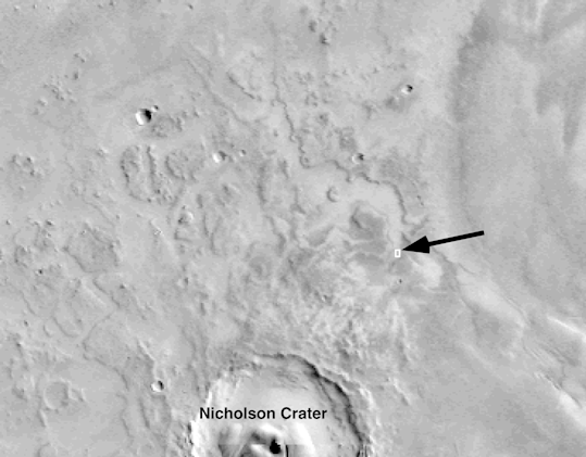
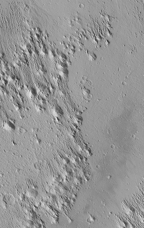
Wind-eroded buttes (round and elliptical knobs) in the Medusae Fossae region of Mars. This image is located about 62 km (39 miles) northeast of the 100 km (62 mile)-diameter impact crater, Nicholson (big crater in (A)), in a low canyon-like area eroded into the local "bedrock". The "bedrock" here is commonly called the "Medusae Fossae Formation," a unit of wind-blasted material that is thought to be composed of easily-eroded sediment or volcanic tephra (ash).The ridges between the buttes are similar to features on Earth called yardangs, which are formed by intense winds that pluck and sand-blast individual grains from a sedimentary deposit such as an ancient lakebed or volcanic ash deposit. Alternatively, some of the ridges may be sand dunes. The origin of the "Medusae Fossae Formation" on Mars is not known for certain. Most evidence suggests that it is composed of thick layers of volcanic ash, although some scientists have suggested that it consists of ancient wind-blown or water-lain sediments that became partially lithified (turned to stone) before being sculpted by wind to form the yardangs we see today.
The MOC image #3104 was taken on October 30, 1997, at 11:05 AM PST, shortly after Mars Global Surveyor spacecraft's 31st closest approach to Mars.
This subframe was featured as Figure 1b of Malin et al., "Early Views of the Martian Surface from the Mars Orbiter Camera of Mars Global Surveyor," Science, v. 279, no. 5357, pp. 1681-1685. Another portion of MOC image #3104 was featured as Figure 1a in the Science paper and on the MSSS Web Site for the December 31, 1997, release.
Malin Space Science Systems and the California Institute of Technology built the MOC using spare hardware from the Mars Observer mission. MSSS operates the camera from its facilities in San Diego, CA. The Jet Propulsion Laboratory's Mars Surveyor Operations Project operates the Mars Global Surveyor spacecraft with its industrial partner, Lockheed Martin Astronautics, from facilities in Pasadena, CA and Denver, CO.
Contact: info@msss.com
 To MSSS Home Page