
MGS MOC Release No. MOC2-219, 8 March 2000
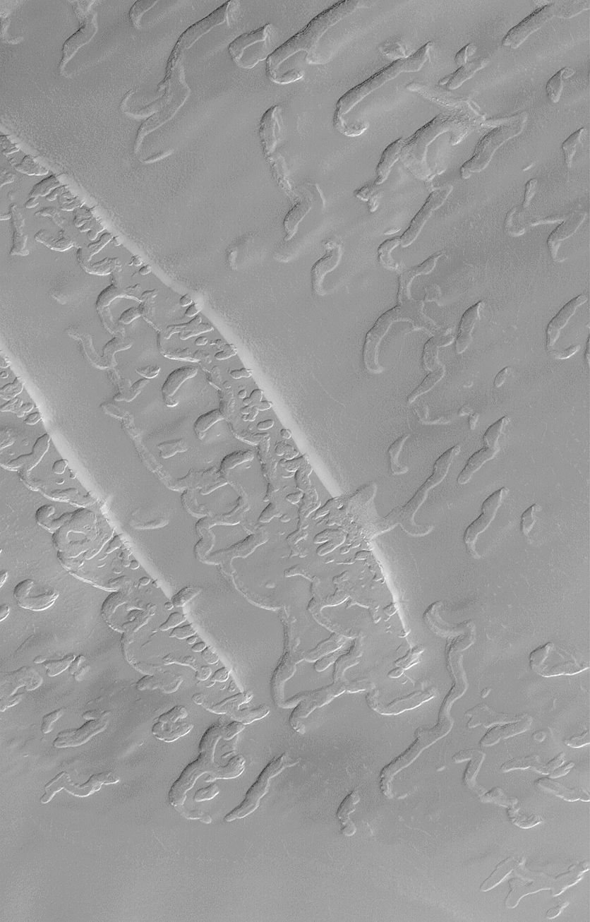
The large pits, troughs, and "swiss cheese" of the south polar residual cap appear to have been formed in the upper 4 or 5 layers of the polar material. Each layer is approximately 2 meters (6.6 feet) thick. Some Mars Global Surveyor (MGS) Mars Orbiter Camera (MOC) images of this terrain show examples in which older pitted and eroded layers have been previously buried and are now being exhumed. The example shown here includes two narrow, diagonal slopes that trend from upper left toward lower right at the left/center portion of the frame. Along the bottoms of these slopes are revealed a layer that underlies them in which there are many more pits and troughs than in the upper layer. It is likely in this case that the lower layer formed its pits and troughs before it was covered by the upper layer. This observation suggests that the troughs, pits, and "swiss cheese" features of the south polar cap are very old and form over long time scales.
The picture is located near 84.6°S, 45.1°W, and covers an area 3 km by 5 km (1.9 x 3.1 mi) at a resolution of about 3.8 meters (12 ft) per pixel. The image was taken during southern spring on August 29, 1999.
Malin Space Science Systems and the California Institute of Technology built the MOC using spare hardware from the Mars Observer mission. MSSS operates the camera from its facilities in San Diego, CA. The Jet Propulsion Laboratory's Mars Surveyor Operations Project operates the Mars Global Surveyor spacecraft with its industrial partner, Lockheed Martin Astronautics, from facilities in Pasadena, CA and Denver, CO.
 To MSSS Home Page