
Mars Global Surveyor Mars Orbiter Camera Release:                   MOC2-8
Mars Global Surveyor Mars Orbiter Camera Image ID:            556602026.71
 Click on image for full resolution version (51 KBytes)
Image acquired 8/21/1997 03:40:24 UTC
Camera Aim Point = 23.6°N, 37.2°W
Range = 5.47 Mkm
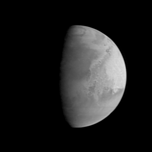
This image of Mars shows an area centered near the Pathfinder landing site. The dark area north of the center of the image along the sunrise terminator is Acidalia Planitia--the Pathfinder landing site is about a third of the way down from this dark area across the light Chryse plains. The bright area near the edge of the planet is Arabia. The lower 40% of the image contains the Xanthe, Margaritifer, and Meridiani highlands, heavily-cratered, ancient areas of the most intense erosion seen on Mars. These will be among the more important targets of the MOC when it begins detailed studies in March 1998.
|
Click Here for more information on MGS data release and archiving plans. |
Contact: info@msss.com
 Return to MSSS Home Page