
Mars Global Surveyor Mars Orbiter Camera Release:                   MOC2-3
Mars Global Surveyor Mars Orbiter Camera Image ID:            556524446.41
 Click on image for full resolution vesion (49 KBytes)
Image acquired 8/20/1997 06:07:24 UTC
Camera Aim Point = 23.6°N, 82.1°W
Range = 5.67 Mkm
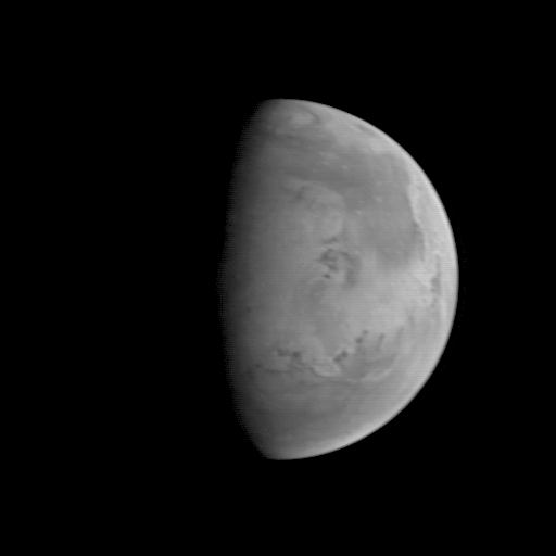
The Mars Orbiter Camera (MOC) took this image on August 20, 1997, when the Mars Global Surveyor (MGS) was 5.67 million kilometers (3.52 million miles) and 22 days from entering orbit. At this distance, the MOC's resolution is about 21.2 km per picture element, and the 6800 km (4200 mile) diameter planet is about 327 pixels across. North is at the top of the image. The MGS spacecraft pointed the camera at the center of the planet (near the dark, morning sunrise line, or terminator) at 23.6° N, 82.1° W. At this distance from Mars, only bright and dark markings resulting from variations in the amount and thickness of dust and sand are visible. The large dark marking stretching from the right center northward is Acidalia Planitia, a region of rock and sand with less dust on it than the area immediately to the south, Chryse Planitia. Both Viking Lander 1 and Pathfinder landed in the latter, bright area. In this low resolution image, some of the dark features resemble the "canals" seen prominently in maps created by astronomers of the 19th and early 20th century. Mariner 9 and Viking images show that most of these dark lines are associated with sand deposits that are trapped in rough areas.
|
Click Here for more information on MGS data release and archiving plans. |
Contact: info@msss.com
 Return to MSSS Home Page