Mars Global Surveyor
Mars Orbiter Camera
Mars Global Surveyor MOC Celebrates 2 Years in Orbit!
MGS MOC Release No. MOC2-177, 13 September 1999
It seems like only yesterday. Mars Global Surveyor (MGS) first reached the
red planet two years ago on September 11, 1997 (Pacific Daylight Time).
The very first high resolution picture acquired by the Mars Orbiter Camera
(MOC) was obtained on the spacecraft's third orbit on September 15, 1997.
This first picture was also the first
twilight image obtained by MOC--the sun had already set and was about
1° below the local horizon. Scattering of sunlight reflected off airborne
dust allowed a small portion of the floor of Lasswitz Crater--a 122 km
(76 mi) diameter basin located at 9.4°S, 221.6°W--to be seen
by the MOC on this first of many thousands of images that were to be
obtained. The MGS spacecraft flew over Lasswitz Crater again on
July 9, 1999--almost 1 martian year later. The new image
taken by MOC had much better viewing conditions--the sun was in a
2 p.m. configuration, the camera was in focus, and the spacecraft altitude
was low enough that the picture obtained has a resolution of about 1.8 meters
(6 feet) per pixel.
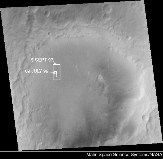
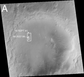
Figure 177-A (top, above) shows Lasswitz Crater as it appeared on July 9, 1999.
Sunlight illuminated the scene from the upper left. The two white boxes
indicate the locations of the very first MOC narrow angle image taken from
orbit around Mars (15 SEPT 97) and a higher-resolution view taken during a
recent Mapping Phase orbit (09 JULY 99). The picture was taken by the
MOC red wide angle camera at the same time that the 09 JULY 99 narrow
angle frame was acquired. The picture has been map-projected so that
north is up.
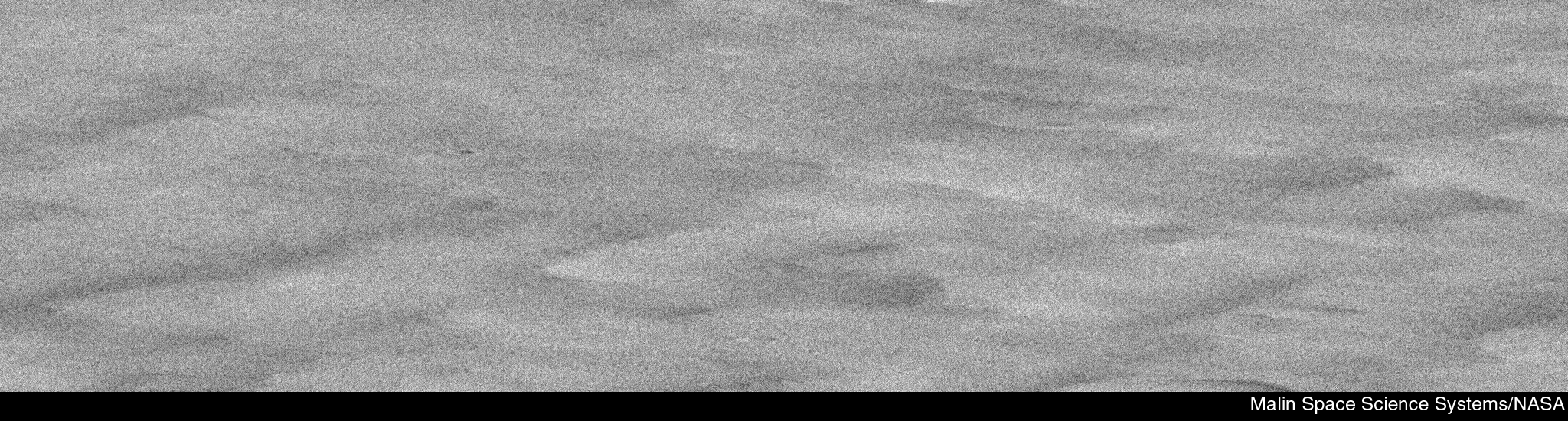
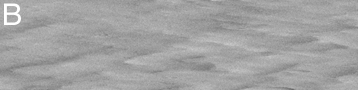
Figure 177-B (middle, above) shows what the first MOC narrow angle view of
Mars looked like before it was map-projected. This image, AB-1-003/05, was
taken from an elliptical, 45-hour orbit on September 15, 1997. The local
time of day on the ground was just after sunset. Each pixel in this image
represents 2.7 meters (9 ft) in the crosstrack (left-right) dimension and
23.7 meters (78 ft) in the downtrack (top-bottom) dimension.
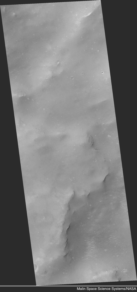
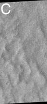
Figure 177-C (bottom, left) shows the September 15, 1997, MOC narrow
angle picture in map-projected form. Here, north is up and illumination
is from the left. The image covers a portion of the floor of Lasswitz Crater
that is about 5.5 km (3.4 miles) wide and 12 km (7.5 miles) long. Low hills
and a few small impact craters can be discerned.
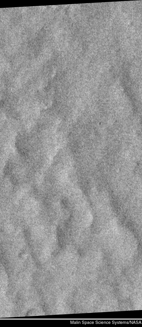
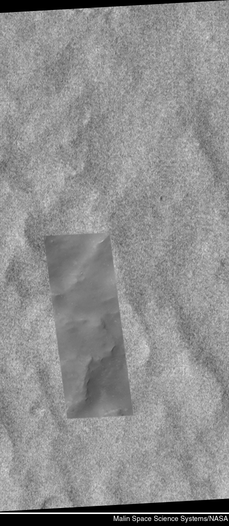
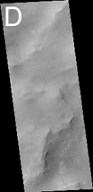
Figure 177-D (bottom, center) shows a portion of the same area on Lasswitz
Crater floor that was covered by MOC in September 1997---only this time
the image was acquired from the ~380 kilometers-(236 miles)-high, 2-hour
MGS Mapping Orbit on July 9, 1999.
The Mapping Orbit was finally achieved in late February
1999, after nearly 1 extra year of careful aerobraking to reduce stress on
one of the spacecraft's solar panels that was damaged shortly after launch
in November 1996. The image shown here covers an area only 1.5 km (0.9 mi)
wide. It shows a relatively
smooth mantle--presumably of dust--covering the hills that were also visible
in the earlier, September 1997 image. Small meteoroids have punctured the
dust cover in places, leaving small, bright-rimmed craters. A few, small,
bright windblown drifts are visible in the lower half of the scene. This
picture is a simple cylindrical map-projected view, north is up and
illumination is from the upper left.
For a full-resolution (1.8 meters--6 feet--per pixel)
view of this image (1.1 Mbytes),
Click HERE.
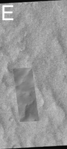
Figure 177-E (bottom, right) shows the September 1997 image overlain by
the July 1999 image (darker inset) to show where the more recent image
is located within the earlier view. North is up and illumination is from
the left. The larger image covers an area approximately
5.5 km (3.4 miles) wide and 12 km (7.5 miles) long. The smaller view is
1.5 km (0.9 mi) wide.
Malin Space Science Systems and the California Institute of Technology
built the MOC using spare hardware from the Mars Observer mission. MSSS
operates the camera from its facilities in San Diego, CA. The Jet Propulsion
Laboratory's Mars Surveyor Operations Project operates the Mars Global Surveyor
spacecraft with its industrial partner, Lockheed Martin Astronautics, from
facilities in Pasadena, CA and Denver, CO.
 To MSSS Home Page
Contact: info@msss.com