
Mars Global Surveyor Mars Orbiter Camera Release:          MOC2-63a, -63b, -63c, -63d
Mars Global Surveyor Mars Orbiter Camera Image ID:         587173304.48107
							   P481-07
|
Click Here for more information on MGS data release and archiving plans. |
CAPTION
Vastitas Borealis--the Northern Vastness--is the name given to the enigmatic northern plains of Mars. In August 1998, the ground track of Mars Global Surveyor's Mars Orbiter Camera (MOC) has evolved such that most of the terrain visible to the imager occurs in the northern lowland plains. Photographing these plains at high spatial resolution has proven to be quite a challenge, however, because the change in available ground track corresponded to a change in martian seasons--from northern winter to northern spring.Springtime at the middle and high latitudes on Mars means clouds. The clouds form as the seasonal (i.e., winter) polar cap frosts and snows sublime and carbon dioxide and water vapor are returned to the atmosphere. In early August 1998, clouds and hazes were especially prevalent over the northern plains of Mars, mainly between about 50°N and 75°N latitude.
As has been the case throughout the Science Phasing Orbit period, the challenge for the MOC team has been to try to guess, about 3 days in advance, which areas within the accessible latitude band will be relatively cloud-free for high resolution imaging. Often this is not possible, but as the season has progressed, the clouds have thinned. Thus, despite the clouds, a few pictures of the northern plains have shown some surface detail. Most of these pictures still appear "murky" because of the thin haze still present in the atmosphere.
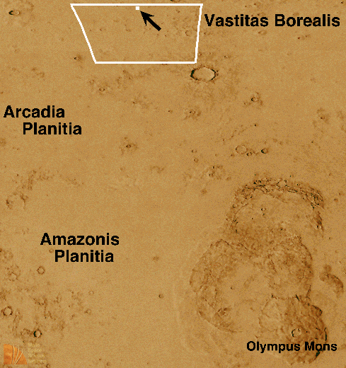
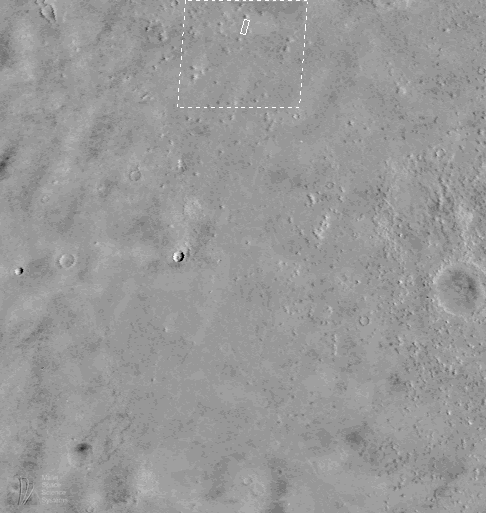
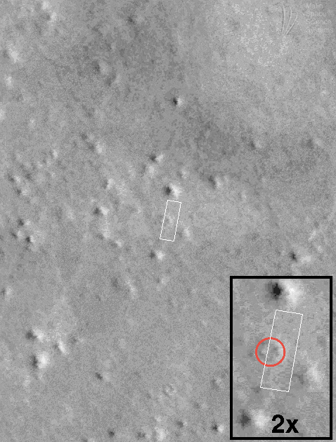
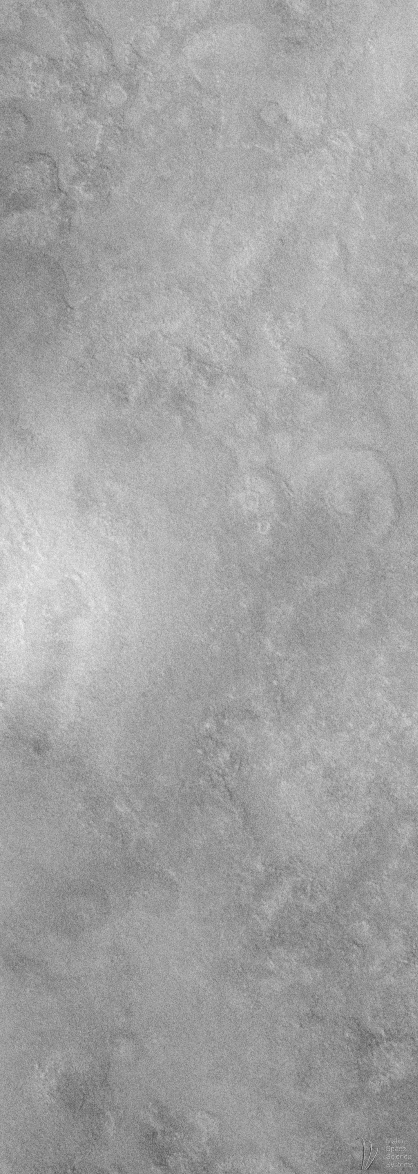
The best example of MOC imaging of the Vastitas Borealis plains obtained as of mid-August 1998 is the image shown here (see (D), above). MOC image 48107 covers an area approximately 4.6 kilometers (2.9 miles) wide and 12.9 kilometers (8.0 miles) long, centered at 64.54°N, 155.71°W. The context maps in (A), (B), and (C), above, show that the MOC image is located north of Arcadia Planitia and several thousand kilometers northwest of the famous Olympus Mons volcano.
The northern plains of Mars have puzzled planetary scientists ever since they were recognized in images from the Mariner 9 orbiter in 1972. The northern plains of Mars are lower than most of the cratered terrains in the martian southern hemisphere, and these plains are considerably lower than the volcanic rises of Tharsis and Elysium. The northern plains have been generally assumed to consist of both volcanic surfaces--e.g., flood basalts--and windblown sediments. An alternative model--that the northern plains are blanketed by sediment from an ocean which might have once covered these lowlands--has gained some popularity recently.
High resolution images of the northern plains are rare. A few taken by the Viking Orbiters in the late 1970s (with resolutions 8-20 meters-- 26-66 feet--per pixel) revealed an eroded, layered landscape. The northern plains show a complex arrangement of old, eroded impact craters, partly buried craters, polygonal cracks that range in scales from tens of meters to tens of kilometers, and vast areas that appear relatively flat and featureless.
The MOC image shows a relatively featureless terrain with some circular depressions that are probably buried or partly buried impact craters. The hummocky (hilly) surface appears to be eroded--probably by wind--but no windblown dunes or drifts are present. There are no obvious lava flow features in the image, although the area covered is so small that the likelihood of seeing such features is very small. The style of erosion suggests that the surficial material was not hard rock, lending some support for the idea that the surface material is a sedimentary deposit. Nothing in this picture, however, provides an adequate test of the competing models for the nature and origin of the northern plains surfaces (e.g., volcanic vs. oceanic vs. windblown materials).
The MOC image was taken during the 481st orbit of Mars Global Surveyor at 4:41 p.m. (PDT) on August 9, 1998. The local time (on Mars) was very early in the morning--the Sun had only risen 8.9° above the horizon--equivalent to about 5:20 a.m.
Malin Space Science Systems and the California Institute of Technology built the MOC using spare hardware from the Mars Observer mission. MSSS operates the camera from its facilities in San Diego, CA. The Jet Propulsion Laboratory's Mars Surveyor Operations Project operates the Mars Global Surveyor spacecraft with its industrial partner, Lockheed Martin Astronautics, from facilities in Pasadena, CA and Denver, CO.
Contact: info@msss.com
 To MSSS Home Page