
Mars Global Surveyor Mars Orbiter Camera Release:          MOC2-55a, -55b
Mars Global Surveyor Mars Orbiter Camera Image ID:         582313884.36507
                                                           P365-07
|
Click Here for more information on MGS data release and archiving plans. |
CAPTION
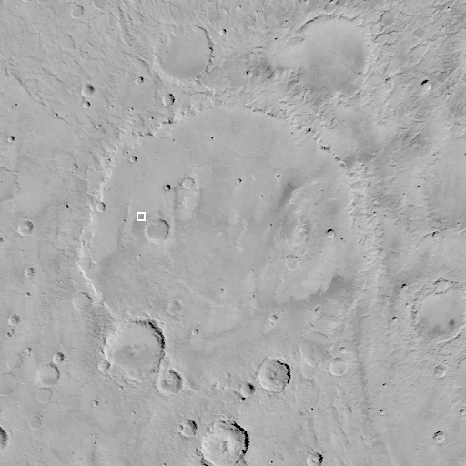
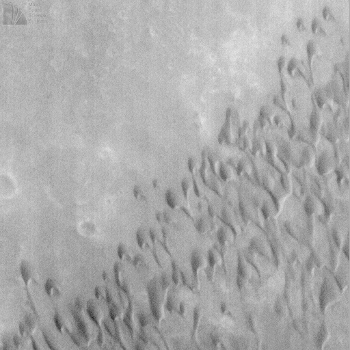
Herschel Basin, one of many meteor impact craters on Mars, has some dark material on its floor that appeared from earlier spacecraft missions to have been blown and/or deposited by wind. Herschel Basin was imaged at low resolution by the Mariner 9 and Viking orbiters ((A) above) in the 1970s, and again by the Phobos 2 orbiter in 1989.On June 14, 1998, Mars Global Surveyor's Mars Orbiter Camera revealed that part of the dark surface on the floor of Herschel Basin consists of a field of sand dunes ((B) above). These dunes have a distinct crescent-like shape characteristic of dunes on Earth called barchan dunes. They result from winds that blow from a single dominant direction.
In the case of Herschel Basin, the dunes indicate that the strongest winds blow approximately north-to-south. The crescent horns on the ends of some of the dunes in this image are elongated. This condition indicates that the dominant winds do not always blow in exactly the same direction--sometimes the winds blow from the northeast, sometimes from the northwest, and sometimes from the north. The local topography probably influences the wind direction--and hence dune shape--because this dune field is located on a narrow, low plain between a high crater rim to the east, and a narrow mountain range-- the inner ring of the Herschel impact basin--to the west (see image (A)).
MOC image 36507 was obtained on Mars Global Surveyor's 365th orbit around 10:51 a.m. PDT on June 14, 1998. The subframe (B) is centered around 14.27°S, 231.68°W.
Malin Space Science Systems and the California Institute of Technology built the MOC using spare hardware from the Mars Observer mission. MSSS operates the camera from its facilities in San Diego, CA. The Jet Propulsion Laboratory's Mars Surveyor Operations Project operates the Mars Global Surveyor spacecraft with its industrial partner, Lockheed Martin Astronautics, from facilities in Pasadena, CA and Denver, CO.
Contact: info@msss.com
 To MSSS Home Page