
Mars Global Surveyor Mars Orbiter Camera Release:          MOC2-54a, -54b, -54c
Mars Global Surveyor Mars Orbiter Camera Image ID:         581978376.35704
                                                           P357-04
|
Click Here for more information on MGS data release and archiving plans. |
CAPTION
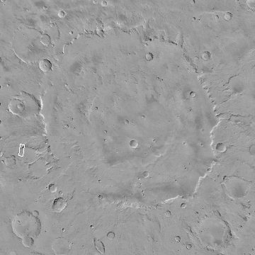
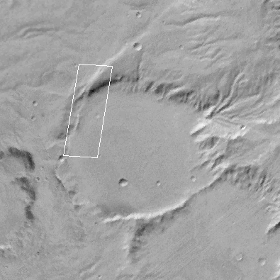
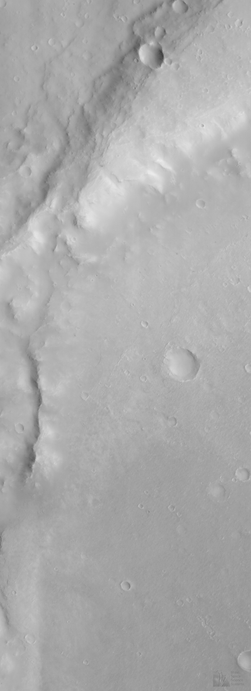
Despite the cloudy skies over much of the martian northern hemisphere in early June 1998, some pictures obtained by MOC have not been cloudy. However, to obtain cloud-free images, the MOC team sometimes has to select low-latitude regions where the image resolution will only be about 10-12 meters (33-39 feet) per pixel, rather than the 2-4 meters (7-13 feet) per pixel available at higher latitudes.The above MOC image, #35704, was obtained on Mars Global Surveyor's 357th orbit. The picture was taken around 1:39 p.m. PDT on June 10, 1998, and its center is around 15.44°S, 309.48°W. This MOC image shows an eroded portion of the thick ejecta (material thrown out of a an impact crater during its formation) from a very large impact basin, Huygens. The ejecta appears to have been eroded such that a previously buried crater (center of (B)) has been exposed. Alternatively, the crater in (B) might have formed after Huygens, but then its eroded appearance would imply considerable erosion and removal of material.
For more details on the fact that MOC images show clouds in the early SPO-2 Observations of Mars, see:
Malin Space Science Systems and the California Institute of Technology built the MOC using spare hardware from the Mars Observer mission. MSSS operates the camera from its facilities in San Diego, CA. The Jet Propulsion Laboratory's Mars Surveyor Operations Project operates the Mars Global Surveyor spacecraft with its industrial partner, Lockheed Martin Astronautics, from facilities in Pasadena, CA and Denver, CO.
Contact: info@msss.com
 To MSSS Home Page