
Mars Global Surveyor Mars Orbiter Camera Release:          MOC2-26A, -26B, -26C
Mars Global Surveyor Mars Orbiter Camera Image ID:         569452395.9503 (P095-03)
                                                           569452407.9505 (P095-05)
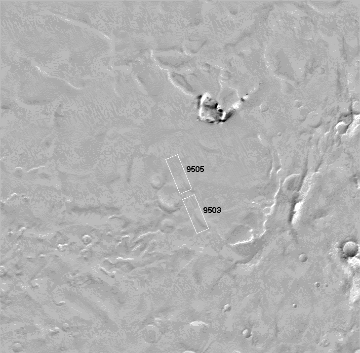
NOTE: There is no image numbered 9504. Owing to a planning glitch, 9504 was inadvertently numbered 9505.
|
Click Here for more information on MGS data release and archiving plans. |
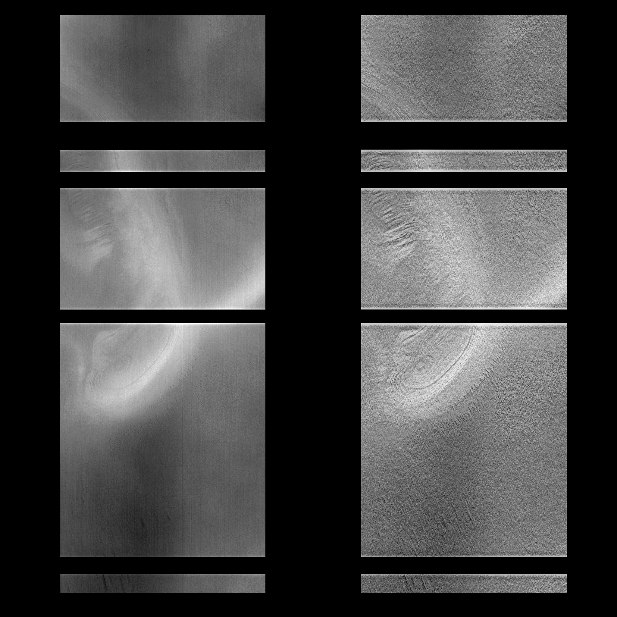
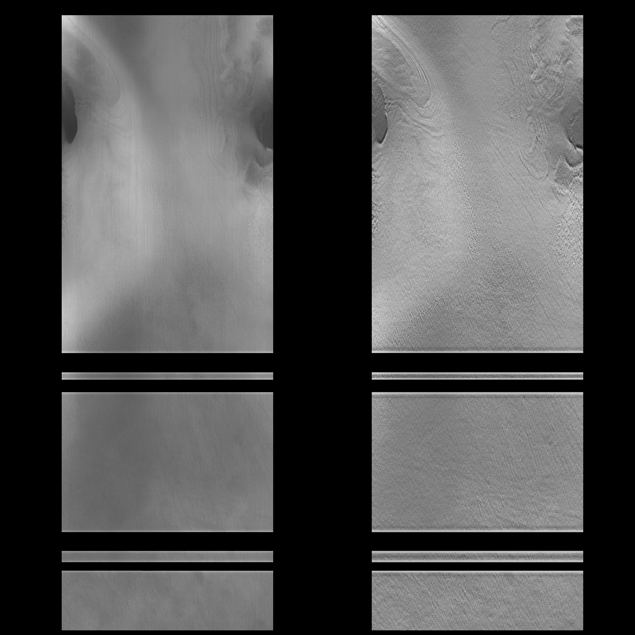
CAPTION
These MOC images (B and C, above) were released 11 February by the Jet Propulsion Laboratory, following processing at JPL's Multimission Image Processing Laboratory (MIPL). In each image pair, the left hand image has been processed to preserve most of the brightness variation (albedo), while the right hand image has been processed to enhance small-scale features at the expense of albedo. Owing to noise in the image, the pictures were processed at one-third their original resolution (which was about 15 m, or about 50 feet, per pixel).The images were acquired at about 1:13 PM PST on January 16, 1998, with the MGS spacecraft over 4300 km (2680 miles) from the surface of Mars. They show enigmatic layered materials that have a range of brightness and contrasts that reflect their composition and how they erode, and in this set of images, especially the subtle slopes that develop from the erosion. Bright areas are believed to have somewhat more ice exposed, and this appears to be concentrated mostly on locally steeper slopes. Dark areas are thought to be dust or sand that has accumulated in a "scum" layer as the underlying ice/dirt mixture evaporated. Occasional "fuzziness" associated with some of the brighter areas may be the result of water-ice fog in the atmosphere immediately above the surface. The dark areas display textures that may result from wind erosion creating streamlined ridges and troughs. Pits and mounds may also develop when variations in dust thickness enhance or retard evaporation of the underlying ice. The broad black stripes across the images result from dropouts while the data are en route from the spacecraft to MSSS.
These images cover an area almost exactly centered on the Mars Surveyor '98 landing zone (75±2°S, 215±30°W). Despite somewhat lower quality relative to other MOC images, they will be extremely important in determining the safest approach to landing in this scientifically exciting area.
Malin Space Science Systems and the California Institute of Technology built the MOC using spare hardware from the Mars Observer mission. MSSS operates the camera from its facilities in San Diego, CA. The Jet Propulsion Laboratory's Mars Surveyor Operations Project operates the Mars Global Surveyor spacecraft with its industrial partner, Lockheed Martin Astronautics, from facilities in Pasadena, CA and Denver, CO.
Contact: info@msss.com
 To MSSS
Home Page
To MSSS
Home Page