
Mars Global Surveyor Mars Orbiter Camera Release:          MOC2-28A, -28B
Mars Global Surveyor Mars Orbiter Camera Image ID:         568174924.8003
                                                           P080-03
|
Click Here for more information on MGS data release and archiving plans. |
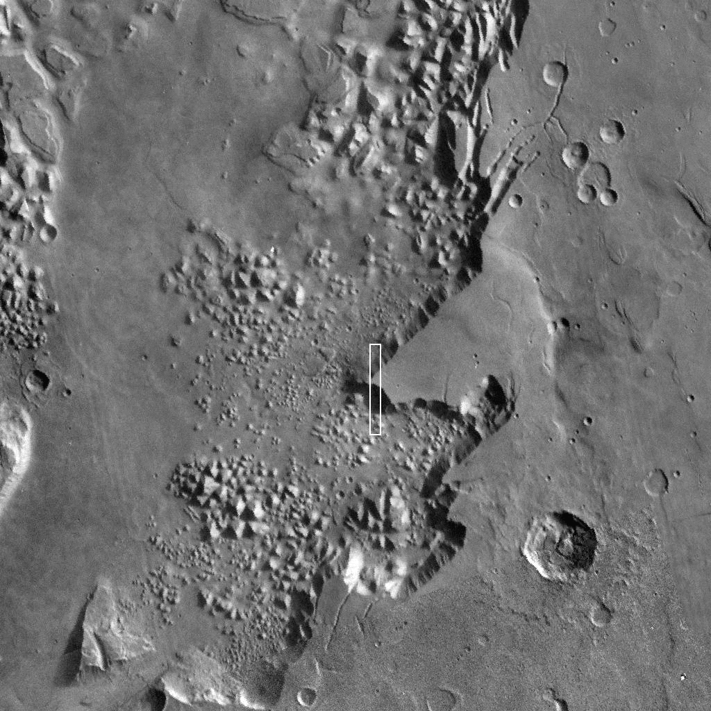
CAPTION
This picture of Martian channeled and chaotic terrain, centered at 1.35°S, 32.96°W, was taken on January 9, 1998, during Mars Global Surveyor's 88th orbit. It shows a 4.8 by 25.0 km (3 by 15.5 mi) view of the transition between a cratered and channeled "upland" surface (top half of the picture) and a lower-lying "chaotic terrain" (bottom half of the picture). On the cliff face that marks the transition, talus chutes (fragmental material on a steep slope) are separated by spurs of bedrock. Some layering can be seen at the top of the bedrock spurs, but not the large number of regular layers seen to great depths in the walls of the Valles Marineris farther to the west.The term "chaotic terrain" is applied to areas where the martian surface has seemingly collapsed to form a jumbled mass of blocks at a lower elevation than the surrounding terrain. Many of the large flood channels emerge from this kind of terrain. It has been suggested that some of the floods formed by violent eruptions of deep groundwater. The eruptions were so violent that part of the bedrock was entrained in the water, causing the ground to collapse after the floods to form the chaotic terrain. This MOC picture is difficult to reconcile with that simple interpretation because the cliff that we see has a very distinct, raised rim. If the low-lying area in the foreground were formed simply by collapse, such a rim would not be expected.
Malin Space Science Systems and the California Institute of Technology built the MOC using spare hardware from the Mars Observer mission. MSSS operates the camera from its facilities in San Diego, CA. The Jet Propulsion Laboratory's Mars Surveyor Operations Project operates the Mars Global Surveyor spacecraft with its industrial partner, Lockheed Martin Astronautics, from facilities in Pasadena, CA and Denver, CO.
Contact: info@msss.com
 To MSSS
Home Page
To MSSS
Home Page