
Mars Global Surveyor Mars Orbiter Camera Release:          MOC2-23A, -23B, -23C
Mars Global Surveyor Mars Orbiter Camera Image ID:         568174924.8003
                                                           P080-03
 (B)
(B) (C)
(C)
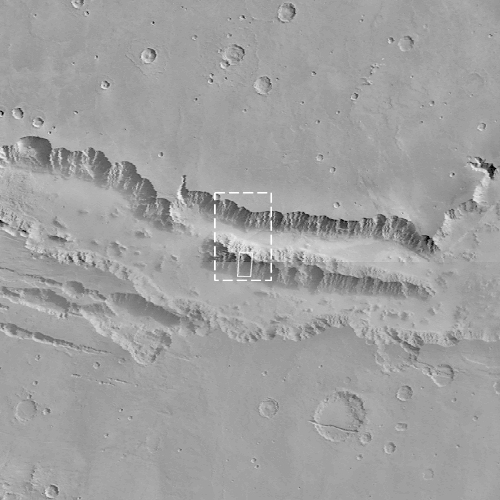
(B) Mosaic of Viking Orbiter 1 frames 428A62, 428A63, and 428A65, reproduced at a scale of 80 meters/pixel (485 KByte GIF) or 40 meters/pixel full resolution (1.61 MBytes). The outline of (C) is shown as a white box.
(C) MOC image 8003 reproduced at a scale of 18 meters/pixel (451 KBytes) or 4.5 meters/pixel full resolution (5.9 MBytes JPG)
|
Click Here for more information on MGS data release and archiving plans. |
CAPTION
This picture (C, above) of the Martian surface was obtained in the early evening of January 1, 1998 by the Mars Orbiter Camera (MOC), shortly after the Mars Global Surveyor spacecraft began it's 80th orbit. Seen in this view are a plateau and surrounding steep slopes within the Valles Marineris, the large system of canyons that stretches 4000 km (2500 mi) along the equator of Mars. The image covers a tiny fraction of the canyons at very high resolution: it extends only 9.8 km by 17.3 km (6.1 mi by 10.7 mi) but captures features as small as 6 m (20 ft) across. The highest terrain in the image is the relatively smooth plateau near the center. Slopes descend to the north and south (upper and lower part of image, respectively) in broad, debris-filled gullies with intervening rocky spurs. Multiple rock layers, varying from a few to a few tens of meters thick, are visible in the steep slopes on the spurs and gullies. Layered rocks on Earth form from sedimentary processes (such as those that formed the layered rocks now seen in Arizona's Grand Canyon) and volcanic processes (such as layering seen in the Waimea Canyon on the island of Kauai). Both origins are possible for the Martian layered rocks seen in this image. In either case, the total thickness of the layered rocks seen in this image implies a complex and extremely active early history for geologic processes on Mars.
Malin Space Science Systems and the California Institute of Technology built the MOC using spare hardware from the Mars Observer mission. MSSS operates the camera from its facilities in San Diego, CA. The Jet Propulsion Laboratory's Mars Surveyor Operations Project operates the Mars Global Surveyor spacecraft with its industrial partner, Lockheed Martin Astronautics, from facilities in Pasadena, CA and Denver, CO.
Contact: info@msss.com
 To MSSS
Home Page
To MSSS
Home Page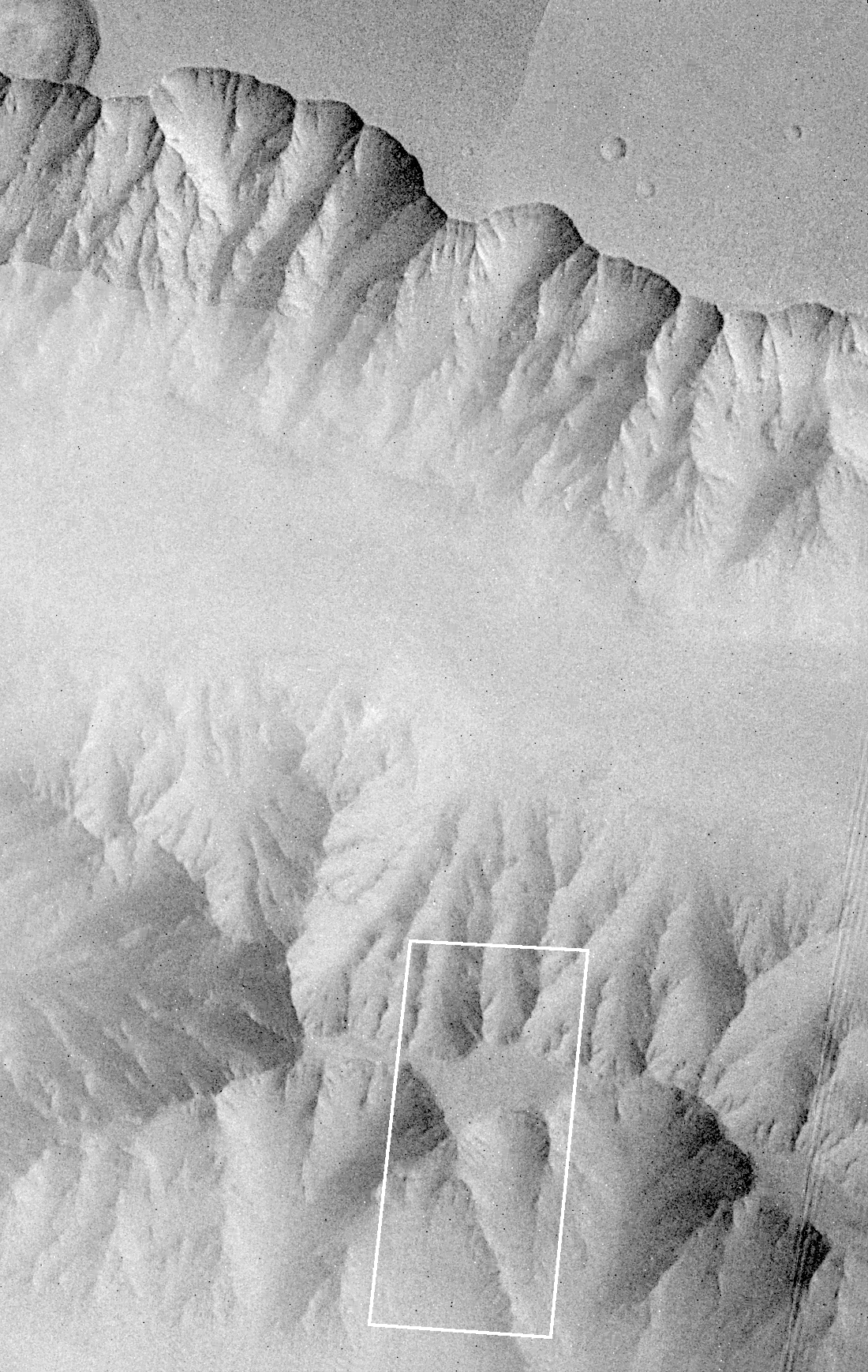